Navigating Maritime Knowledge, Shaping Policy, Inspiring Action
The Institute for Maritime and Ocean Affairs, Inc. (IMOA) is a non-profit organization dedicated to conducting research and fostering public engagement on Philippine maritime and ocean affairs, providing resources and insights for advocacy, education, and policy development.
Defending Philippine Sovereignty:
Legal Insights and Territorial Rights
This section delves into the legal, historical, and geopolitical aspects of Philippine sovereignty, highlighting the importance of defending territorial rights in the West Philippine Sea. It provides a comprehensive analysis of the Philippines’ claims, addressing challenges from external forces and emphasizing the need for national unity and updated maps to safeguard vital maritime territories like Benham Rise.
Defending Philippine Sovereign Rights in the West Philippine Sea
In the lecture “Defending Philippine Sovereign Rights in the West Philippine Sea,” retired Senior Associate Justice Antonio T. Carpio of the Supreme Court of the Philippines offers a detailed analysis of the legal and historical foundations behind the Philippines’ claims in the West Philippine Sea. He delves into key treaties, international laws, and historical documents that reinforce the nation’s position, while stressing the importance of defending these rights against external challenges. Justice Carpio also calls for national unity and greater awareness in protecting the country’s maritime territories, aiming to educate Filipinos about the vital role the West Philippine Sea plays in the nation’s sovereignty and future.
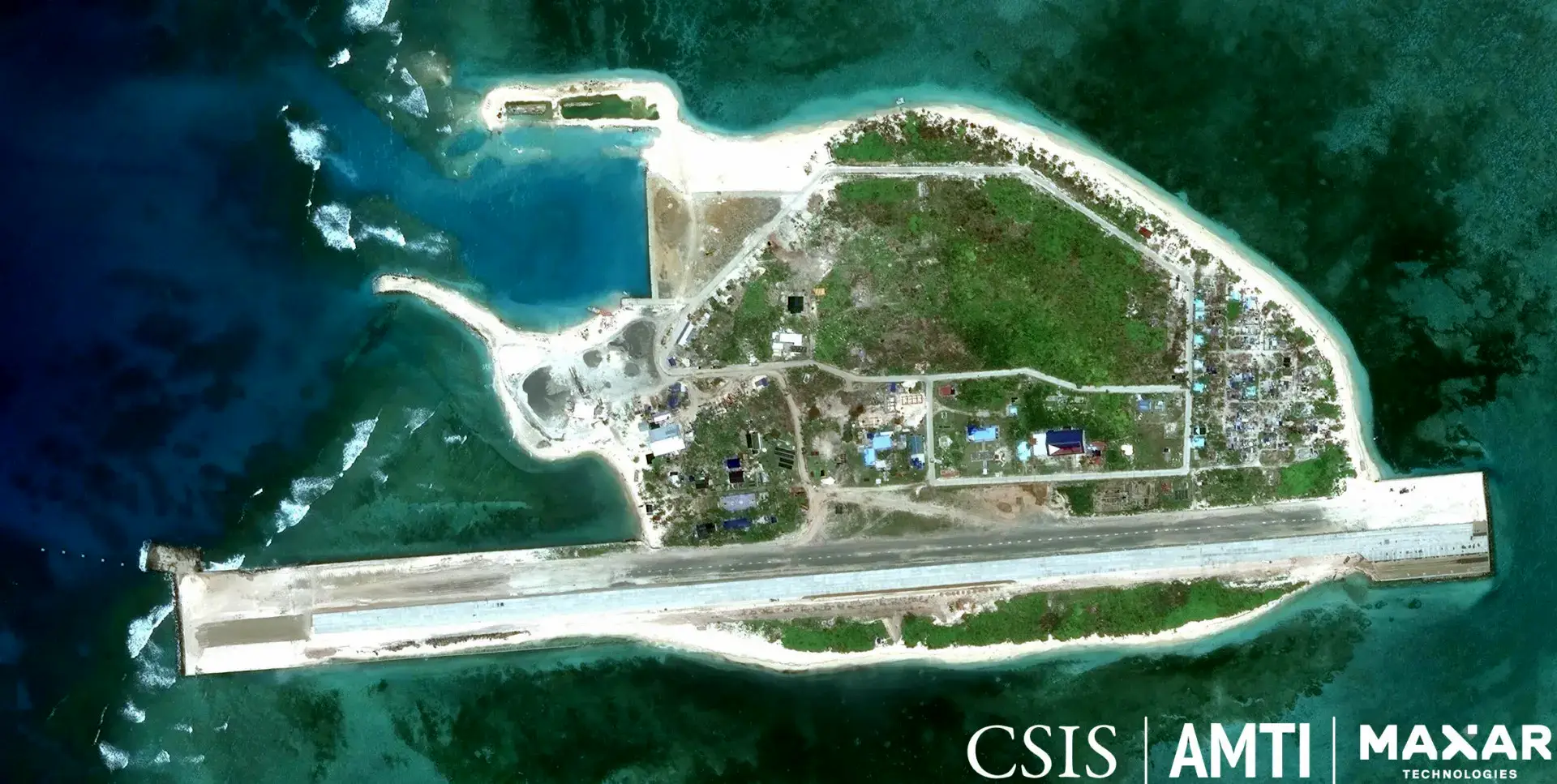
Philippine Island Territories in the West Philippine Sea
The video is a lecture by Justice Antonio T. Carpio (Ret.) on May 25, 2024, at an online forum organized by various Filipino organizations. Justice Carpio explores the Philippine Island Territories in the West Philippine Sea, examining the historical, legal, and geopolitical aspects of the Philippines’ claims. He provides a thorough analysis, debunking pro-China politicians who undermine the country’s territorial integrity. He also stresses the importance of updating Philippine maps to include territories like Benham Rise, reinforcing the nation’s sovereignty. The video aims to enlighten Filipinos about their territorial rights and inspire engagement in patriotic activities to defend the nation’s maritime boundaries.
Philippine Sovereign Rights and Jurisdiction in the West Philippine Sea eBook

In the ongoing struggle to assert the Philippines’ sovereignty over the West Philippine Sea, The South China Sea Dispute: Philippine Sovereign Rights and Jurisdiction in the West Philippine Sea offers an invaluable resource. This eBook compiles over 140 lectures and speeches by retired Senior Associate Justice Antonio T. Carpio, delivered over a span of five years from October 2011 to March 2017. With a focus on the legal and historical foundations of the Philippines’ territorial claims, the collection provides critical insights into the nation’s fight for its rights in the face of external pressures. It also sheds light on the historic arbitral award in favor of the Philippines, reinforcing the significance of the West Philippine Sea to the country’s sovereignty and future. This eBook serves as an essential tool for Filipinos and global citizens alike, aiming to foster a deeper understanding of the geopolitical issues at play and the importance of defending national interests.
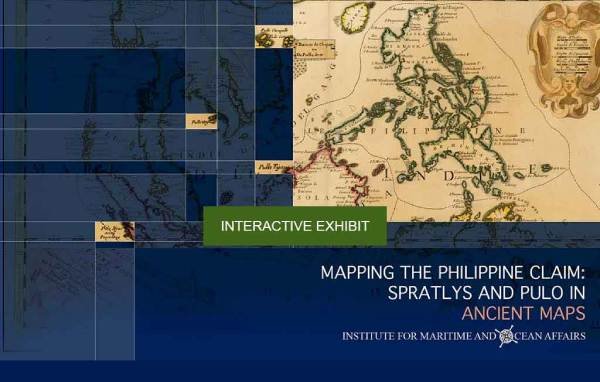
Mapping the Philippine Claim: Spratlys and Pulo in Ancient Maps
Discover the rich history behind the Philippine claim to the Spratlys and Scarborough Shoal through this interactive map. Explore centuries-old maps that provide compelling evidence of the country’s territorial heritage and showcase the narratives etched in cartographic history. Click on any map to zoom in, pan around, and uncover intricate details that connect the past to the present.
Dive into history—engage with the maps now and see the story unfold in every detail!

Historical Truths and Lies: Scaborough Shoal in Ancient Maps
Welcome to our interactive map exhibit, a digital journey through centuries of maritime history. Explore ancient maps and uncover the historical context of the West Philippine Sea dispute, with a special focus on Scarborough Shoal. This platform brings together meticulously curated maps from various periods, offering insights into the historical links of claimant states. By presenting these maps in an accessible format, we aim to foster a deeper understanding of the historical facts and promote informed discussions rooted in truth.
Begin your exploration and join us in navigating history through the lens of ancient cartography

This Google Earth image highlights the Philippines, showcasing its vast maritime territory, including its Exclusive Economic Zone (EEZ) and the numerous islands and features within its jurisdiction. From the rich waters of the West Philippine Sea to the remote features of the Philippine Rise, this visualization underscores the nation’s sovereignty over its natural resources and its strategic role in the region. It serves as a powerful reminder of the geographical and ecological significance of the Philippines in the global maritime landscape.