New images reveal the extent of China’s land reclamation and construction in the South China Sea. Experts warn the new developments will make it increasingly difficult to counter Beijing’s regional claims.
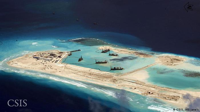
On February 4, the Philippines filed a diplomatic protest to the Chinese Embassy in Manila, urging Beijing to stop the land reclamation at the Mischief Reef. Manila argued that the dredging activities at the reef – located some 135 kilometers southeast of the Philippine island of Palawan – were in violation of its exclusive economic zone. But no photographs of the construction at the reef had been made publicly available until now.
Surveillance imagery obtained by the Center for Strategic & International Studies (CSIS), a Washington-based think tank, now shows the size and scope of China’s building and land reclamation projects in the Spratly Islands, a highly contested area in the South China Sea.
The photographs, released on February 18, focus on six reefs claimed by China in the area – the Gaven Reef, Johnson South Reef, Fiery Cross Reef, Mischief Reef, Cuarteron Reef, Hughes reef – and reveal that the development of these features has taken place at a much larger scale and faster rate than expected, according to analysts.
Read more: http://www.dw.de/how-china-is-transforming-the-south-china-sea/a-18271485