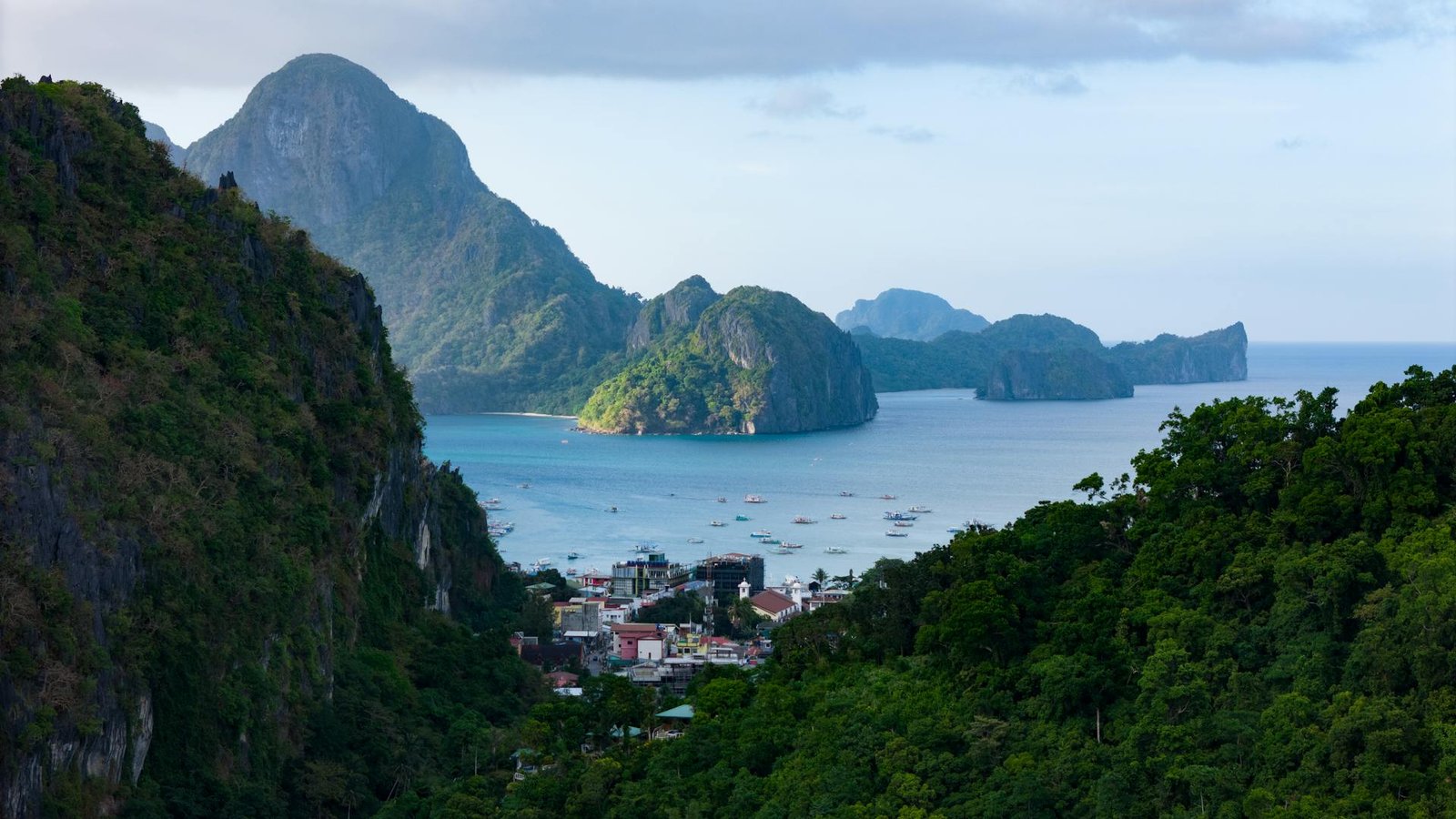
For generations, Filipinos grew up reciting the familiar phrase: “The Philippines is an archipelago of 7,107 islands.” It was a cultural staple, a geographic identity, and a point of quiet pride. But as with many things in the modern era, science has reshaped what we know.
Today, thanks to state-of-the-art satellite imaging and geographic information systems, the National Mapping and Resource Information Authority (NAMRIA) has updated the official count to 7,641 islands. Most of these newly identified landforms are small, uninhabited, and previously unmapped—but they are no less a part of the national patrimony.
This scientific development does more than refresh a statistic. It strengthens the Philippines’ position in the ongoing effort to safeguard its maritime rights in the West Philippine Sea.
A Modern Archipelago in a Strategic Sea
The Philippine archipelago does not merely exist on paper; it is a living mosaic of coastlines, reefs, islets, and ecological sanctuaries. With every improvement in mapping technology, our understanding of this mosaic becomes clearer—and the extent of our jurisdiction becomes harder to dispute.
The newly confirmed islands underscore three realities:
1. The Philippines has one of the world’s most geographically complex archipelagos.
This complexity translates into one of the longest coastlines on Earth, a vast network of marine habitats, and an extensive maritime domain that demands careful management and firm protection.
2. Many of these islands—and the waters around them—fall within areas where the Philippines exercises sovereign rights under international law.
Under UNCLOS and the 2016 Arbitral Award, the Philippines has exclusive rights to resources within its Exclusive Economic Zone (EEZ) in the West Philippine Sea. Scientific mapping that identifies landforms, features, and ecological zones helps strengthen understanding of what must be protected.
3. Improved mapping reduces ambiguity—something particularly valuable in contested waters.
Precision matters. When a nation knows exactly what it owns, it can defend it more effectively.
Science as a Sovereignty Tool
The discovery of hundreds of new islands was made possible by Interferometric Synthetic Aperture Radar (IFSAR)—a remote-sensing technology capable of detecting narrow land strips, tiny islets, and features previously blurred by older methods.
This doesn’t create new territory.
Instead, it reveals territory that was always ours but never fully documented.
In the context of the West Philippine Sea, where the Philippines continues to face coercive behaviors and illegal incursions, science becomes a quiet but powerful ally:
- It strengthens maritime baselines.
- It sharpens environmental monitoring.
- It provides high-resolution data for diplomatic and legal work.
- It supports the Philippines’ narrative that understanding and stewardship—not aggression—guide its actions.
An Archipelago of Life and National Identity
Beyond geopolitics, the expanded island count tells a story of abundance.
Many of the newly identified islands host vital ecosystems—mangrove nurseries, coral sanctuaries, sea-grass meadows, and migratory bird habitats. These are silent guardians of biodiversity and natural buffers against climate impacts.
They also remind us that the Philippines is larger, richer, and more diverse than many imagine. In a region where artificial islands are being built to alter geopolitical realities, the Philippines stands on something far more compelling: natural formations shaped by time, tides, and the forces of nature.
Our claim rests not on concrete and dredgers, but on geology, ecology, history, and law.
National Pride in a Time of Maritime Challenges
The updated count of 7,641 islands invites us to view the Philippines with renewed appreciation: not merely as a country of beaches and sunsets, but as a maritime nation whose geography is inseparable from its identity and rights.
Every island—big or small, known or newly mapped—adds to the geographic and cultural tapestry that Filipinos are called to protect.
Amid the ongoing struggle to uphold our sovereign rights in the West Philippine Sea, the expanded island count carries a symbolic resonance:
We are a larger nation than we once believed.
We are a more diverse nation than we once understood.
And we are a maritime nation with responsibilities—not just claims—across our seas.
The Path Forward
Promoting the Philippines in the context of the West Philippine Sea issue means highlighting what truly sets the nation apart:
- A science-backed understanding of its maritime territory
- A long legal tradition rooted in international norms
- A geography blessed with natural richness
- A people whose relationship with the sea is deep and centuries-old
Whether we speak of 7,107 islands or 7,641, one truth remains constant:
Every island strengthens the Philippines’ identity and reinforces its rightful place in the South China Sea/West Philippine Sea.
And as the science improves, so does our capacity to defend what is ours—peacefully, lawfully, and with unwavering resolve.
Primary Sources on the Updated Island Count
1. NAMRIA confirmation of new islands (400–500 newly detected)
GMA News report quoting NAMRIA about discovering additional islands through modern mapping:
https://www.gmanetwork.com/news/news/nation/555068/namria-discovers-400-to-500-new-islands-in-phl-archipelago/story/
2. Explanation of the count increase & IFSAR technology
GMA News feature explaining how NAMRIA used high-resolution mapping to update the national count:
https://www.gmanetwork.com/news/lifestyle/content/867836/does-the-philippines-still-have-7-107-islands-kuya-kim-answers/story/
3. General public reporting of the updated number (7,641 islands)
Philippine Primer article summarizing NAMRIA’s official update:
https://primer.com.ph/blog/2017/03/11/total-number-of-philippine-islands-is-now-7641/
4. Additional analysis and public discussion of the revised island count
S1 Expeditions article discussing NAMRIA’s new mapping and the increase in island count:
https://www.s1expeditions.com/2015/09/203-philippine-islands-count.html
Neutral/Reference Sources Reflecting the Updated Number
5. Wikipedia — List of Philippine Islands (reflects 7,641 figure)
https://en.wikipedia.org/wiki/List_of_islands_of_the_Philippines
(This is a summary resource, but it reflects the current consensus based on NAMRIA’s update.)
Secondary / Contextual Sources
6. Article discussing island count variability and public understanding
SunStar Cebu commentary on the revised number and NAMRIA’s explanation:
https://www.sunstar.com.ph/more-articles/pena-7500-islands
7. Biodiversity & ecological context (Philippine maritime environment)
ICRI case study mentioning PH marine biodiversity and environmental management:
https://icriforum.org/wp-content/uploads/2024/03/ICRI_NBSAP_Case_Study_Philippines_V2.pdf
(Does not mention the 7,641 figure but supports statements about ecological richness.)